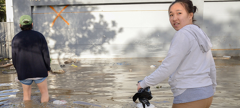
Rock Springs, the San Jose neighborhood hit hardest by the Feb. 21 Coyote Creek flood, may finally get the help it needs to withstand a future deluge.
The Santa Clara Valley Water District on Tuesday will discuss plans to extend flood walls and levees another few miles upstream to Tully Road. That would protect Rock Springs from the kind of flood that happens about every 25 years—the kind that devastated the neighborhood back in February. But the agency pegs only $600,000 for the proposal at this point. How it will pay for the rest remains to be seen.
District officials secured about $39 million for flood protection through a 15-year parcel tax approved by voters in 2000. About $10 million was spent on planning, but not much work was done to protect riverside neighborhoods from the kind of flood that happens about once every 100 years.
The U.S. Army Corps of Engineers considered chipping in several million dollars for the project more than a decade ago, but decided that it would cost too much. A federal law passed in 1983 requires the Corps to only fund a project if the price justifies the benefits. The feds determined that for Rock Springs—a community of about 1,600 mostly low-income Vietnamese and Latino residents—the price of protection would outweigh the value of the property.
That left the water district, the South Bay’s leading flood control agency, with a shortfall that limited the planned flood protection scope to a six-mile span from Montague Expressway through Interstate 280. In 2003, the water district estimated that building all the necessary fortifications would cost anywhere from $500 million to $1 billion.
District officials estimated that for Rock Springs alone, it would have amounted to about $5.7 million to protect the neighborhood from a 50-year-flood and $5.2 million to protect it from a 25-year flood. But nothing got past the planning stages because the district couldn’t get money from Congress or the state.
When the Coyote Creek jumped its banks in February, it caused an estimated $100 million in damage. That wasn’t even a once-in-a-century flood—it was the type that strikes every 25 years or so. The largest flow ever recorded on Coyote Creek was in 1911, which predates the region’s two reservoirs. After that, the creek flooded again in 1917, 1931, 1958, 1982, 1983, 1997 and 1998.
While the water district has built levees around Alviso and downtown San Jose along the Guadalupe River, it did nothing to defend Rock Springs. Neither the district nor the city of San Jose, which owns much of the land along Coyote Creek, adequately maintained the waterways or cleared vegetation and debris. The flood protection parcel tax came up for renewal in 2012, but no additional funding was allocated for Coyote Creek.
When the river overtopped its banks earlier this year, the water district called it the worst flooding from Montague to Tully since the Anderson Dam was built in 1950. Scores of businesses and hundreds of homes were inundated with filthy water, prompting last-minute rescues and evacuations. Dozens of people were forced to live in emergency shelters for months to come.
In the wake of the February flood, public outrage took aim at the city for failing to sound the alarm in time for people to evacuate and salvage some of their possessions. The water district also came under fire for failing to prioritize the kind of infrastructure that would have minimized or prevented the damage that displaced entire communities.
In April, the water district board decided to take a fresh look at the Coyote Creek flood protection plans tabled years ago for a lack of money. Tuesday’s meeting will focus on how to leverage local funding and forge a partnership with the feds and the state. It will also include a discussion about immediately allocating $600,000 to move forward with planning and design this year.
Click here to read the meeting agenda.


AJ
How much design and planning will that $600,000 buy to protect my neighborhood from flooding next winter? What is it that we get now that the $10 million spent previously could not buy us and save us from the february flooding? How was that $10 million spent? We need an accounting for what it was spent on?
AJ,
just check the boards bank accounts, pensions, special individual projects and buyouts and you will find where the money is going. Not called the golden cash cows for a reason. And you will never get a accounting that is true from these losers.
The main function of Santa Clara Valley Water District is to maximize pay and benefits for it’s employees and especially it’s executives. Maintaining clean, unobstructed waterways and providing flood protection are far down it’s priority list and seen as rather a nuisance.