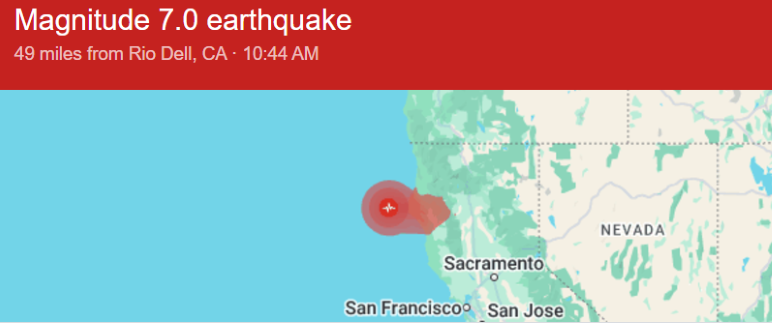
A massive earthquake ruptured off California’s coast on this morning, briefly triggering a tsunami warning for the coast of Northern California and southern Oregon.
The earthquake, a magnitude-7.0 temblor, rumbled at around 10:44am, about 42 miles west of Ferndale, California, according to the United States Geological Survey.
The quake damaged homes and utilities in Humboldt County, and was felt in San Francisco, Pacifica and in communities along the San Mateo and Santa Cruz County coast.
After the warning, the San Francisco Zoo was closed and some schools along the coast and the east bay were evacuated.
The tsunami warning was issued for the coast between from Davenport to the border between Douglas and Lane counties in Oregon. The Tsunami Warning Center canceled the warning at about 11:55am.
Humboldt County, the community on land closest to the epicenter, reported no injuries or fatalities so far, but county officials reported broken water mains, broken windows and houses off their foundation
About 10,000 people were without power in Humboldt County, according to NBC News.
The Lost Coast Outpost, a local news site, reported a “mass exodus from low-lying areas in Eureka and Arcata.”
“Traffic was really thick on the highway and through Eureka’s side streets,” the news site reported. “It was a good drill for The Big One. This was not The Big One.”
Earthquakes can trigger tsunamis when they displace the seafloor, causing waves that can rush toward shore. A tsunami warning indicates that significant inundation and coastal flooding is expected, based on preliminary information about the quake’s position.
Harold Tobin, the director of the Pacific Northwest Seismic Network, told media that the 7.0-magnitude temblor was a strike-slip earthquake. Strike-slip earthquakes take place when two plates slide past one another.
The quake ruptured in the Mendocino fault zone, at the intersection of three tectonic plates – the Pacific, North American and Juan de Fuca plates.
“This is the exact point where the Cascadia Subduction Zone ends to the south and the San Andreas Fault begins,” Tobin said in a statement to NBC News. “It’s the most seismically active place in California, overall, over the past decades. It’s not a surprise to get an earthquake of this magnitude.”
Tobin said this was the highest-magnitude earthquake produced in the area since the 1990s.
Tobin said the earthquake did not take place on the Cascadia Subduction Zone and that it was not likely to increase the risk of an earthquake there.
The Cascadia Subduction Zone is one of the biggest hazards in the U.S. The fault runs offshore along U.S. West Coast from Northern California to northern Vancouver Island. It's capable of producing magnitude-9.0 earthquakes and tsunami waves about 100 feet tall.

